Bay of Fundy International Marathon
Bay Of Fundy International Marathon
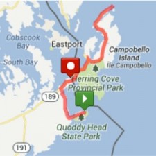
The first Bay of Fundy International Marathon, set for Lubec and Campobello Island on June 23, has been granted status as a qualifying race for the 2014 Boston Marathon.Hotel, inn and restaurant owners on the island of Campobello in New Brunswick and in the small town of Lubec and beyond are preparing for the large influx of runners. More than 500 already have signed up for the marathon and its companion 10-kilometer race.The marathon begins at the West Quoddy Lighthouse in Lubec, goes up to the East Quoddy Lighthouse on New Brunswick’s Campobello Island, and returns to finish on Lubec’s Water Street – crossing the Roosevelt International Bridge and thus the border with New Brunswick twice.
Maine will now have five races that are certified as qualifiers for 2014 Boston Marathon:Great Cranberry Island Marathon on Great Cranberry Island; Sugarloaf Marathon in Kingfield; Bay of Fundy International Marathon in Lubec; Maine Marathon in Portland; and the Mount Desert Island Marathon in Southwest Harbor.
Already more than 480 marathoners from 36 states, Washington D.C., six provinces and Uruguay have registered for the Bay of Fundy marathon, which has a June 7 registration deadline, Katherine Cassidy of Lubec, the race’s founder, said in a recent email. The event also has 205 more runners signed up for the same-morning 10K race, which takes place within Lubec. Deadline for registering for the 10K is June 22.
Cassidy first began dreaming about the marathon more than five years ago.
“I first had the idea in 2007, came up with a likely route, drove it many times alone, but didn’t share the marathon thought with anyone else until 2010,” she said. “I was always stopped by the question, ‘How do we get runners across the border, and back?”
But a marathon committee worked for months with Canadian and American border officials to make sure each racer is pre-screened and cleared to allow them to run unimpeded across the border, she said.
Cassidy has a solid background in marathons. In the 1990s she traveled to 43 marathons in 43 countries as a freelance writer for running and athletic magazines.
Cassidy and Sue Keef of Campobello serve as the organizing committee’s co-chairs. Ron Beckwith, superintendent of Roosevelt Campobello International Park, is the marathon’s honorary chair.
Obtaining the necessary ranking to allow the Bay of Fundy marathon to be a qualifying race for the Boston Marathon of 2014 was achieved earlier this month when the course measurement and certification was accepted by the national body for long-distance running – U.S.A. Track and Field. The same paperwork details were accepted by Athletics Canada for similar certification in Canada, Cassidy said.
Cassidy said marathoners choose races with Boston Marathon-qualifying courses. The Boston Marathon maintains strict qualifying times and requirements according to age-groups.
To properly measure the course, Fundy Marathon director John Hough and a team of volunteers covered the Lubec-Campobello course on bicycles over several days to a precise 26.2 miles – twice the certification rules.
“A huge thank you goes to all the people of Campobello and Lubec who have put up with us delaying traffic on the roads for the last month or so,” Hough said. “We also thank the staff of the Canada and USA border posts at the Roosevelt Memorial Bridge who, I think, found our repeated bicycle antics rather amusing.”
Full details of the race course and requirements can be found at www.bayoffundymarathon.com, or by calling (207) 619-1887.
Cassidy has a solid background in marathons. In the 1990s she traveled to 43 marathons in 43 countries as a freelance writer for running and athletic magazines.
Cassidy and Sue Keef of Campobello serve as the organizing committee’s co-chairs. Ron Beckwith, superintendent of Roosevelt Campobello International Park, is the marathon’s honorary chair.
Obtaining the necessary ranking to allow the Bay of Fundy marathon to be a qualifying race for the Boston Marathon of 2014 was achieved earlier this month when the course measurement and certification was accepted by the national body for long-distance running – U.S.A. Track and Field. The same paperwork details were accepted by Athletics Canada for similar certification in Canada, Cassidy said.
Cassidy said marathoners choose races with Boston Marathon-qualifying courses. The Boston Marathon maintains strict qualifying times and requirements according to age-groups.
To properly measure the course, Fundy Marathon director John Hough and a team of volunteers covered the Lubec-Campobello course on bicycles over several days to a precise 26.2 miles – twice the certification rules.
“A huge thank you goes to all the people of Campobello and Lubec who have put up with us delaying traffic on the roads for the last month or so,” Hough said. “We also thank the staff of the Canada and USA border posts at the Roosevelt Memorial Bridge who, I think, found our repeated bicycle antics rather amusing.”
Full details of the race course, go to www.BayOfFundymarathon.com or call (207) 619-1887.
The FDR/Campobello International Park
The FDR/Campobello International Park
The FDR/Campobello International Park is located at:
459 Route 774
Welshpool (Campobello Island), New Brunswick
Canada E5E 1A4
The Park is opens the Saturday just prior to Memorial Day.
In 2013, that is May 25th and they stay open until October 19th.
Hours of Operation are Daily from 10 a.m. to 6 p.m. (Atlantic time).
Telephone: 506-752-2922.
It is always advisable to call first.
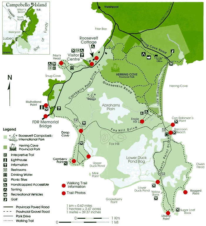
The map below shows three areas of green. The light green (at the bottom) shows the area that is jointly owned and maintained by the governments of United States and Canada.
The medium-green area (in the middle) shows the area that is owned and maintained solely by the Provincial Government of New Brunswick.
The darker-green area (toward the top) shows the start of that part of the island that is non-government owned.
Herring Cove Provincial Park, Campground & Beach
Herring Cove Provincial Park
Herring Cove Provincial Park consists of 88+ camp sights, a 9-hole golf course, hiking trails, biking trails and a pebble beach. The mile long beach is just below the famed Fundy Properties and is a a great place to walk, talk, collect rocks, kayak and observe porpoises and whales.
The park is located at:
136 Herring Cove Rd.
Campobello Island, New Brunswick
Canada E5E 1B8
Telephone: 506-752-7010
Or Toll-Free: 800-561-0123
2013 Dates of Operation:
Camping: May 31 to September 28
Golf: from May 3 until October 9
Restaurant Hours of Operation:
From 7 a.m. to 10 p.m.
Payment Methods
Visa, MasterCard, American Express, Interac Direct Payment and Cash
Whale and Seal Watching
Whale and Seal Watching
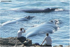 If you are fortunate enough to own waterfront property on Campobello Island, whale and seal watching can be done from most any vantage point from mid-July through mid-September.
For the more adventurous, whale and seal watching in the Bay of Fundy has been commercialized with three or four local companies offering half-day excursions.
Lighthouses
Lighthouses
East Quoddy Lighthouse
East Quoddy Lighthouse (a.k.a. Head Harbour Lightstation to the locals) is situated at the northernmost tip of Campobello Island. It is the oldest lighthouse in New Brunswick and is privately funded through donations.

One interesting feature of the lighthouse is that it is inaccessible to pedestrian traffic most of the time. To get to the lighthouse, one must walk along a path that is only present at low tide. Since low tide occurs only four times each day and at least one of the four events is in total darkness, it makes getting to the lighthouse something that could be commercialized with only a little effort.
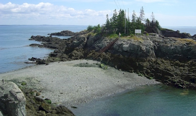
At any time of the day, a dozen or more vehicles will be parked at the observation site.
Mulholland Point Lighthouse
Mulholland Point Lighthouse is situated at the southwestern tip of Campobello Island and is no longer inactive service.
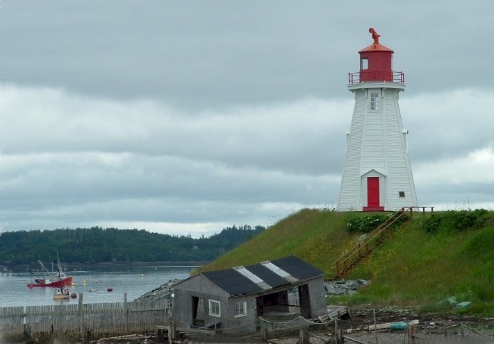
Mulholland Point Lighthouse was built in 1885 and served as a guide for the many small coasters, passenger ships, and freighters traversing the narrow Lubec Channel en route to or from the United States or Canadian ports on Grand Manan Island, just south of Campobello Island.

Although Mulholland Lighthouse is not open to the public, visitors are free to walk around the structure and to enjoy the picnic site next to it. From the picnic area at Mulholland Point are views of the FDR Memorial Bridge, Lubec, Maine and the Lubec Channel Lighthouse.
Lubec Channel Lighthouse (a.k.a. Sparkplug Lighthouse)
Sparkplug Lighthouse is situated in the Lubec Channel just southeast of the FDR International Bridge. In the picture below, the bridge can be spotted just to the right of the base of this massive structure.

It was one of 17 Maine Sparkplugs commissioned by the United States and is fully operational. There are only three of these famous “sparkplugs” left today in Maine.
Lubec Channel Light was built at the harbor’s western entrance for $20,000 in 1889 with a life expectance of 100 years. In 1989 when the light was to be decommissioned, the local residents mounted a “Save the Sparkplug” campaign. Automobile sparkplugs were handed out to gain attention for the cause.
In 1992, a $700,000 renovation restored old Sparky to its best condition in decades. The renovation included the stabilization of the foundation, which had developed a slight tilt over the years. New plates were installed on the caisson and approximately 200 cubic yards of concrete was pumped into its’ base. Twelve (12) piles were then driven through the caisson into the bedrock. One of the piles was driven 149 feet.
In the summer of 2001, the lighthouse received a new coat of paint and other maintenance from the U.S. Coast Guard.
West Quoddy Lighthouse
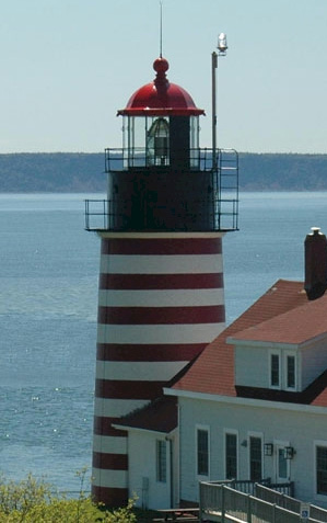 Perhaps the most famous and most photographed lighthouse in the world is West Quoddy Lighthouse, literally at the easternmost tip of the United States in Lubec.
This most famous piece of architecture operates 24/7 and is staffed by an all-volunteer crew for tours and a paid light keeper who lives in the upstairs of the house along with his family. In an attempt to extend the life of this lighthouse, access to the actual tower and stairway is limited to only one day each year – usually around the week that envelops Independence Day.
Bird Watching
Bird Watching
Golf
Golf
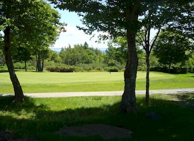 In 1977 the Herring Cove Provincial Park opened a 9-hole golf course overlooking the Bay of Fundy.
The course has ample room for expansion as it is situated on approximately 250 acres. Because the Provincial Government maintains the course, fees are kept to a minimum. The cost to play is $20 for 9 holes or $30 or 18 holes and slightly less after 5 o’clock PM.
Hiking & Biking Trails
Hiking & Biking Trails
Camping
Camping
Herring Cove’s 1,049 acres feature 88 campsites, including 40 with electrical hook-ups, tent cabins, fire pits, washrooms, picnic tables, kitchen shelters, showers, laundry facility, playgrounds, hiking trails, beach, 9-hole golf course, pro shop, and a restaurant. Around the mile-long beach, you will find sea urchins, a rich bog and sheer cliffs.
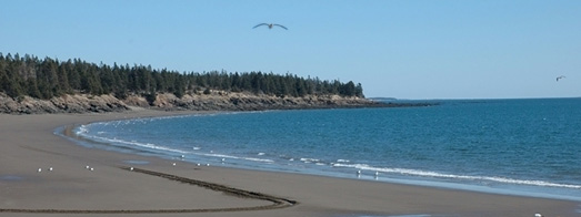
Wildlife and birdlife abound at Herring Cove. Bald eagles, osprey and beavers are among the many species that can be observed along the trails at this attraction.
Old Sow Whirlpool
Old Sow Whirlpool
The waters of the Bay of Fundy produce an amazing 7 billion cubic feet of tidal action into and out of the areas around the island. This happens every six hours. With this, the largest natural whirlpool in the world is formed between the western edge of Campobello and the eastern edge of Eastport, ME, dubbed “Old Sow.”
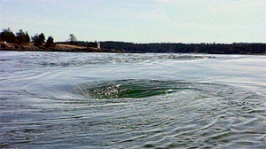
Old Sow is legendary in that it has actually devoured seamen in non-motorized boats throughout the centuries. This Davy Jones’ Locker of sorts is safe provided a one maintains a certain distance. Local inhabitants, fishermen and ferryboat operators know this and respect Old Sow.
Campobello Island
Whirling on the Canadian side of the international border in waters called Western Passage between Eastport and Deer Island, the Old Sow whirlpool boasts currents of more than six knots, tides reaching 26 feet and chartered depths of 405 feet.
Coastal information has repeatedly called Old Sow the world’s largest whirlpool, while a few conservative texts call her the largest whirlpool in this hemisphere. From 1817 to 1995, a number of boats and at least 10 people have met their end as a result of Old Sow, which is most dangerous on the flood tide, especially for small boats.
Early Old Sow deaths: The earliest fatality was submitted by Deer Island resident Glenna Barteau and comes from the December 31, 1817 City Gazette of St. John. It reads: “Drowned, Henry Hall, merchant, Moose Island, James Stewart, merchant, St. Stephen, George Veith, Commissariat of St. Andrews…, Capt. Hows, Mr. Bateman owner of the passage boat which Tuesday [December] 23d was caught in a whirlpool near Dog Island while leaving Moose Island.”
Eastport historian and author Joyce Kinney joins Barteau in referring to the March 28th, 1830 drowning of the three Stover brothers. Barteau found the reference in the April 10, 1830, New Brunswick Courier. “Drowned 28th off Deer Island, three brothers, the sons of Stover widow.”
According to Barteau, the Saint Croix Courier of March 30, 1871 had a report that read; “Drowned – a man named Norwood was drowned from a boat off Deer Island Point on Friday last [March 24, 1871]. Deceased belonged to Eastport.
Grace B. Carter also referred to this death in an article for Yankee magazine; “There was the wreck of a two-masted schooner the Quickstep owned and operated by two Norwood brothers, Robert and Abner. They accidentally got into currents near the pools one day just as a squall struck. They couldn’t handle her. She went straight into Old Sow and disappeared with both men. Not a stick of her timbers was ever found or anything seen of Abner again. Robert was picked up some time later by a coaster, both arms locked around an oar, his head in the water, but alive”.
The wind sailing era changed with the advent of the gasoline engine, and with it the number of Old Sow deaths dropped. While there are present-day reports of large ships being turned askew by the turbulent waters, drownings and sinkings have been rare since the turn of the century. There have, however, been two.
Cecil Chaffee drowned at age 44 (possibly in 1912) while rowing near Old Sow. James Roland Mitchell Sr. was drowned in 1943 when he stood up to fix the rudder of his sailboat and the boom swung around and knocked him out of the boat. It is not clear whether wind or tide or both were responsible for this accident. Both men were from Eastport.
Another manpower feat was the Quoddy Tidal Project, which Kinney maintains reduced old Sow’s strength. The project, begun during the 1930′s, created two dams (from Eastport to Carlow Island and from Carlow Island to the mainland at Perry), which formed a causeway and became state highway Route 190. Kinney maintains the causeway interrupted the waters, which previously swirled in an unrestricted manner around the circumferences of Moose and Dog islands.
On May 2nd, 1995, a 55-foot Deer Island fishing boat, the Fundy Star II sank off Indian Island near Deer Island Point and Old Sow. According to a Quoddy Tides article, the vessel, coming around Deer Island Point and loaded with tanks of salmon smolts, “hit the flood tide … and suddenly keeled over and onto it’s side.” The three men aboard escaped injury by managing “to pilot the boat a few hundred feet north” into less dangerous waters, where they were rescued by a nearby fishing boat.
Eastport, ME
Eastport, ME
Eastport, Maine is the principal city of Moose Island, which is west and slightly north of Campobello Island. Its’ history is recorded as far back as 1600.
For years, Eastport has been noted as being the eastern-most “city” in the United States, while Lubec remains the eastern-most “town” in the United States.
The population grew with the emergence of the sardine fishery and related canning businesses, which studded the shoreline by the end of the nineteenth century. A large marina in the center of the town still serves the local fisherman.
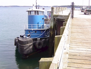
As the industry declined, many people moved away. The city went bankrupt in 1937. In 1976, the Groundhog Day Gale destroyed many structures on the waterfront.
There is an international ferry crossing to Deer Island during the summer months. Eastport’s 4th of July is a destination for thousands of celebrants. Navy ships have docked there during the 4th of July celebration for many years.
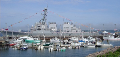
The city celebrated its bicentennial in 1998. In 2001, Eastport was the setting of the Reality-TV show “Murder in Small Town X”, with Gary Fredo. In the show, Eastport was referred to as “Sunrise, Maine.”

During the spring and summer season, Eastport is alive with many arts and craft shops, antique shops, street vendors and more.
New Years Eve in Eastport
New Years Eve in Eastport
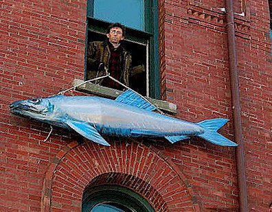 The first sardine cannery in the United States opened in 1875 in Eastport, Maine. So that people don’t forget, the residents of Eastport have used New Years Eve to celebrate this fact. The tradition involves an 8-foot wooden and fabric sardine sculpture, which is lowered from the top of the local art museum, right at the stroke of midnight. Hundreds of town folk line up to kiss the fish, signifying their wish for good luck in the upcoming year.
This has always been great fun for Eastporters and so in 2012, they were happy to share their celebration with CNN. Originating from Times Square, CNN would (from time to time), break away to peek into the downtown area of Eastport while their correspondent, Gary Tuchman, would cover the Great Sardine Drop. Unfortunately, the good people of Eastport will probably only remember the mockery that was made of them by the vulgarness of “comedian” Kathy Griffin when she tried to turn their fun into something perverted.
You can read about her sick stunt in a reprint from the Boston Globe in the Appendix.
Lubec, ME
Lubec, ME
Lubec Maine is the eastern-most “town” in the United States and connects Campobello Island to the United States via the FDR International Bridge. Like Eastport to its’ north, Lubec is primarily a fishing village.
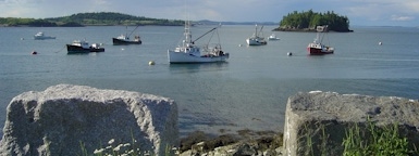
Sometime during the late 19th century, Lubec succeeded Eastport as the sardine canning capitol of the world. From 1881 to 1898, 23 sardine factories had started up in Lubec alone. The maximum pack in the history of the business occurred in 1950: 3,806,000 cases. From this peak in 1950, it has been straight downhill for two reasons. One, the industry was overbuilt in the war years. Secondly, the industry had tariff protections from its earliest days against the lower wages of foreign competition. By 1975, the plants in the state had dwindled from 48 to 15.
Lubec is now a town in transition. It is learning to make the shift from a fishing village to a tourist destination. Each season has its’ own special allure. There are several Bed & Breakfast Inns in Lubec as well as restaurants that serve some of the best fish in all of New England.

