My Campobello
  • Home
  • About Campobello Island
    • Geography & Demographics
    • Island History
    • Local Industry
    • Notables
    • Accommodations
    • Food
    • Getting Here
    • Communications
    • Climate & Weather
    • Emergency Services
  • Galleries
    • Oceanfront Property For Sale
    • Wondrous Campobello Island
    • FDR Influence
    • Head Harbor Light
    • Mulholland Light
    • Sparkplug Light
    • West Quoddy Light
    • FDR International Bridge
    • Historical Photos
    • Local Wildlife
    • Eastport, ME
    • Lubec, ME
    • Maps
  • Attractions
    • Lubec, ME
    • New Years Eve in Eastport
    • Eastport, ME
    • Old Sow Whirlpool
    • Camping
    • Hiking And Biking Trails
    • Golf
    • Bird Watching
    • Lighthouses
    • Whale and Seal Watching
    • Herring Cove Provincial Park
    • The FDR/Campobello International Park
    • Bay Of Fundy International Marathon
  • Events
    • Sunday – June 15, 2014
      2nd Bay of Fundy Marathon
    • Friday – June 28, 2013
      Day 1 of Canada Day
    • Saturday – June 29, 2013
      Day 2 of Canada Day
    • Sunday – June 30, 2013
      Day 3 of Canada Day
    • Monday – July 1, 2013
      Day 4 of Canada Day
    • Saturday – July 27, 2013
      Roosevelt Cup Challenge
    • Sunday – July 28, 2013
      Roosevelt Cup Challenge Continues
  • Property For Sale
Home» About the Island » Geography & Demographics

Geography

Campobello Island consists of approximately 9,800 acres of land in the Bay of Fundy at the most extreme easternmost tip of the State of Maine in the US.

Map

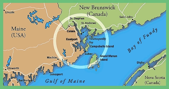
The island measure approximately three (3) miles wide and nine (9) miles long and is situated in a southwest to northeast direction. Campobello Island’s only physical geographic connection is to the United States and via the FDR International Bridge at the southwestern most tip of the island.

Most of the western side of the island is tidal while the eastern side of the 0island is cliff lined. Both tidal land and cliffs can be found on the northern and southern exposures.

Elevations range anywhere from zero meters above MSL (Mean Sea Level) in the tidal areas to as much as 80 meters above MSL in others.

As with most islands, it was formed by volcanic activity and as such, the island is made up of a granite base and granite edged cliffs.

Fertile topsoil completely covers the island suggesting that it was formed millions of years ago.

Demographics

Campobello Island’s year round population of 1200 is made up almost entirely of Canadian and American Caucasians of modest income. By contrast, the summer population is made up almost entirely of American Caucasians of upper income. The largest segment of the summer population appears to be from the southern part of the United States, which suggests that people are drawn this area to escape the heat and humidity.

Contact Us

  • 207-470-0090 (Camden, ME)
  • info@myCampobello.com

Picture Gallery

Click Here for a variety of Galleries celebrating Campobello Island, the Bay Of Fundy, Eastport, ME, Lubec, ME and the entire Quoddy Loop.

Copyright (c) 2004~2015 - MyCampobello.com